More info
Find Travel Agents Near You
Mount Wilhelm is Papua New Guinea’s highest peak at 4,509 metres, rising from the Bismarck Range where Simbu, Jiwaka, and Madang provinces meet. It is a major natural landmark known for its alpine lakes, dramatic terrain, and accessible summit route.
Mount Wilhelm stands as one of the country’s most recognisable geological features. Its combination of height, cultural value, and diverse landscapes makes it a key destination for trekkers, nature travellers, and visitors wanting to experience PNG’s highlands.
Attribute | Detail |
Elevation | 4,509 metres |
Location | Border of Simbu, Jiwaka, and Madang provinces |
Mountain Range | Bismarck Range |
Difficulty Rating | Moderate to challenging, depending on weather and fitness |
Average Climb Duration | 2 to 3 days |
Temperature Range | 0°C to 10°C at higher altitudes, often below freezing at night |
Best Months to Climb | June to September |
Facilities Available | Base camp huts, local guesthouses, guided trekking services |
Mount Wilhelm is located on the border of Simbu, Jiwaka, and Madang provinces in Papua New Guinea. Its summit sits within the Bismarck Range, a major mountain system that runs through the country’s highlands.
Most climbers access the mountain from the Keglsugl and Gembogl side in Simbu Province, which offers the most established route and facilities. The Pindaunde side provides an alternative approach but is less commonly used.
Kundiawa lies about 60 kilometres from the main trailhead at Keglsugl, with travel times ranging from 1.5 to 2 hours depending on road conditions. Goroka, in the Eastern Highlands Province, sits roughly 90 kilometres away and acts as another regional gateway for visitors heading into the area.
Mount Wilhelm holds significance as Papua New Guinea’s highest point at 4,509 metres, forming one of the most prominent peaks in the Bismarck Range and rising well above the surrounding highlands.
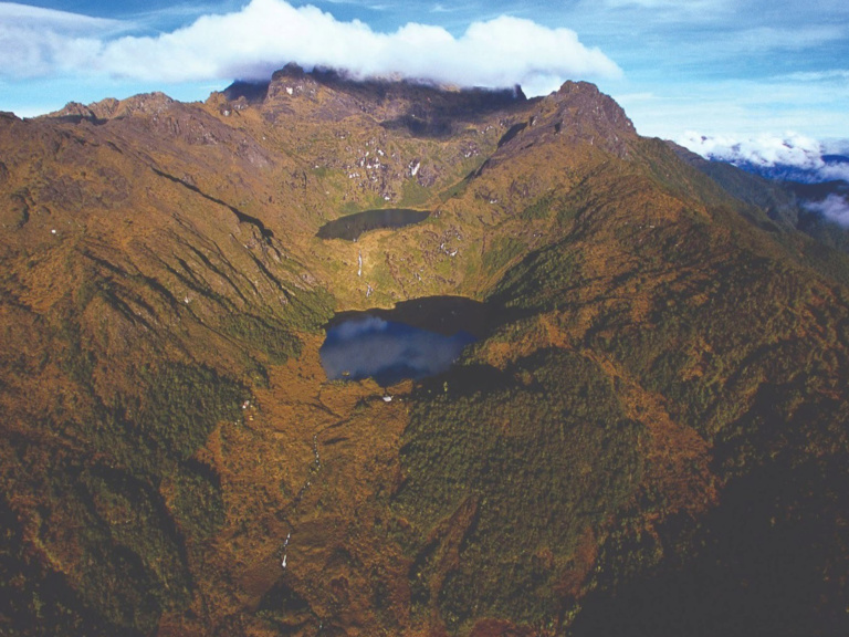
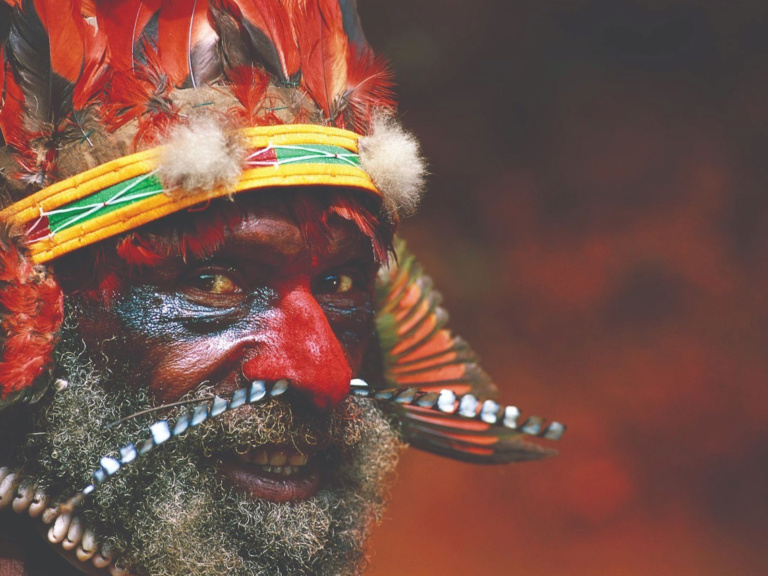
The mountain is closely connected to local communities, with stories, traditions, and land stewardship shaping the way visitors experience the region. Its geological features include steep ridgelines, glacial valleys, and a cluster of alpine lakes that sit between 3,400 and 3,900 metres.
Wildlife commonly seen in the area includes species such as Stephanie’s Astrapia, Mountain Kingfisher, and Papuan Scrubwren, while alpine vegetation features heaths, moss forests, and high-altitude grasses that appear above 3,000 metres.
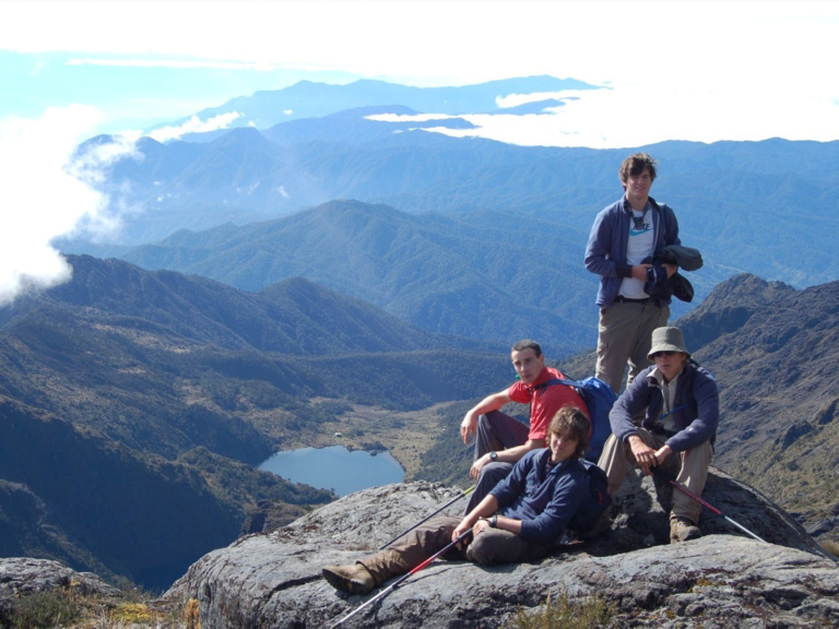
Climbing Mount Wilhelm typically involves a 2 to 3 day trek that moves from lower mountain villages into the high-altitude lake region before a final ascent to the summit. Most visitors follow an established route on the Simbu side, which offers a steady climb through forests, grasslands, and open alpine terrain.
The trek is usually broken into stages, with an overnight stay near the lakes to help with rest and acclimatisation. Temperatures become noticeably cooler at higher elevations, and nights can feel cold even during the drier months.
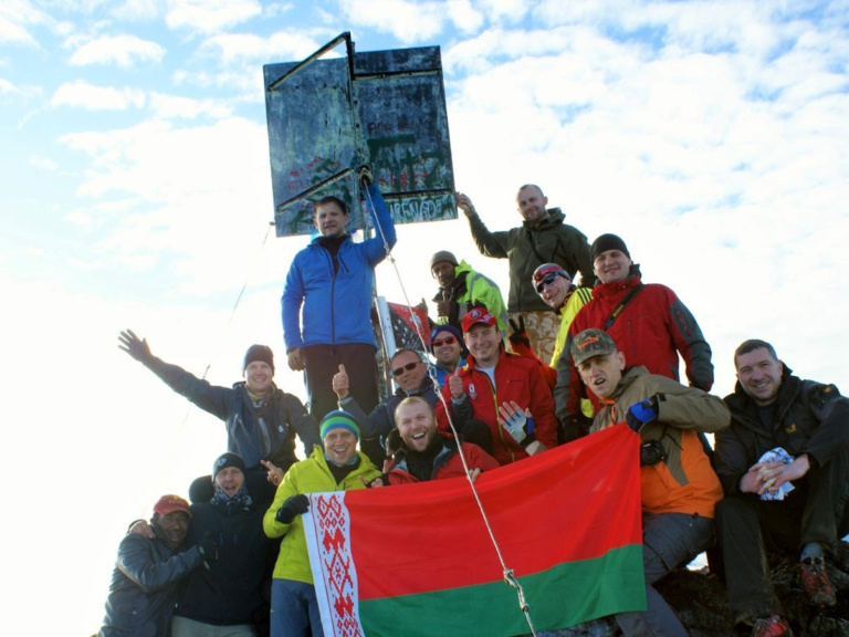
The summit attempt generally begins well before sunrise, allowing climbers to reach the peak while conditions are calmer and views are clearer. The upper section includes steep rocky slopes and reduced visibility in the early morning, so a slow and steady pace is important.
Reaching the summit and returning to the trailhead often takes most of the day. A good level of fitness is recommended, as trekking at altitude and over varied terrain can be demanding regardless of the route taken.
Stage | Altitude | Approx. Time | What to Expect |
Trailhead (Betty’s Place) → Base Camp | ~2,800 m to ~3,500 m | 3 to 5 hours | Gradual ascent through forest and grassland, arrival at Lake Piunde and Lake Aunde, simple hut accommodation. |
Base Camp → Summit | ~3,500 m to 4,509 m | 4 to 7 hours | Pre-dawn start, rocky terrain, colder temperatures, sunrise views from the ridge near the peak. |
Summit → Trailhead | 4,509 m to ~2,800 m | 6 to 8 hours | Long descent back to base camp and the lodge, careful footing on rocks above the lakes. |
The best months to climb Mount Wilhelm are June to September, when conditions are drier and more stable. These months offer clearer skies, lower rainfall, and safer footing on the upper slopes.
Temperatures at higher altitudes range from 0°C to 10°C during the day and often fall below freezing at night. Rainfall increases outside the dry season, creating slippery tracks, poor visibility, and a higher chance of storms during the afternoon.
The key safety principle on Mount Wilhelm is preparing for rapid and unpredictable weather changes at high altitude. Clear mornings can shift to dense cloud or rain with little warning, and visibility can drop to 5 to 10 metres during sudden cloud cover.
Climbing with a local guide adds essential knowledge of the track, weather patterns, and emergency procedures. Altitude can affect some climbers above 3,000 metres, with symptoms such as headaches, fatigue, and nausea becoming more noticeable during the summit push.
Staying warm, pacing steadily, and allowing time for acclimatisation helps manage these conditions and contributes to a safer climb.
Climbers encounter high-altitude lakes, alpine plants, wildlife, and sweeping views across the highlands.
The lakes near the upper camps — Aunde, Piunde, and Pinde — sit in a dramatic basin surrounded by grasslands and rocky ridgelines. Alpine vegetation becomes more noticeable at higher elevations, with hardy shrubs, mosses, and grasses adapted to cooler temperatures.
Birdlife is often seen along the track, including species such as Stephanie’s Astrapia and other highland birds known for their distinctive calls and colours. On clear mornings, panoramic views from the upper slopes can reach as far as the Bismarck Sea, giving climbers a sense of the mountain’s scale within the wider region.
Accommodation near Mount Wilhelm includes several guesthouses in the Keglsugl and Gembogl areas, which provide simple rooms, home-style meals, and local guidance before and after the climb. Betty’s Place is one of the best-known options in this region, offering comfortable guest rooms, garden surroundings, local cuisine and easy access to the main trail.
Basic huts are situated near the lakes and serve as overnight shelters for climbers; facilities vary and may include simple bunk beds or basic shelter rather than full amenities.
Visitors often combine a Mount Wilhelm trek with experiences across the surrounding highlands. Goroka offers markets, cultural attractions, and access to regional flights, while the Chimbu Valley is known for its village life and traditional practices.
Coffee plantations across the highlands provide tours and tastings, giving travellers insight into one of Papua New Guinea’s key industries. Short walks around nearby lakes, waterfalls, and viewpoints add variety to an itinerary and showcase more of the region’s natural scenery.
Ready to plan your Mount Wilhelm adventure? If you have questions about the climb or want help exploring more of Papua New Guinea, contact our team for guidance.
Thank you for submitting your registration for the PNG Tourism Sector Legislation Review!
Spaces are limited per consultation, so only registered participants will be contacted.
Kind regards,
The Papua New Guinea Tourism Promotion Authority

Thank you for submitting your business form. We will have our team look over the details and then contact you once we have added your details to our website.